Committee approves floodplain map for Chelsea Lake
Residents living around Chelsea Lake will have some new rules when it comes to where and what they can build on their properties.
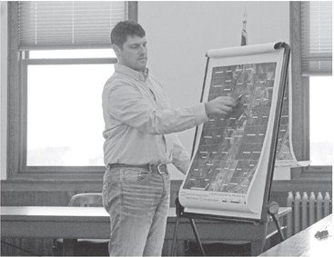
On December 19, members of the Taylor County zoning and solid waste committee voted to approve a floodplain zoning map for the area engineers determined to be in the dam’s flood shadow.
The flood shadow is the area that would be flooded in the case of a catastrophic dam failure. County zoning administrator Kyle Noonan noted that with a 100-year storm all the roads below the dam would be overtopped. The goal of the floodplain zoning is to limit possible new construction in the area that would be most impacted by a flooding event.
The benefit to the county and the nearby property owners would be that without the zoning restrictions it is considered a high risk dam, while setting up these new development rules will change its status to being a low risk dam. As a result, it would potentially lower the number of inspection requirements.
From a practical standpoint, the floodplain zoning restrictions will have little impact on the property owners because the area is swampy lowland that is not suitable for development. “There is not a lot of potential for building on a lot of that property,” said committee member Jim Gebuaer.
Noonan said he did not believe there would be any impact to the property values as a result of the zoning. The extent of the zoning area was determined through a Dam Failure Analysis conducted by Flambeau Engineering. It was based on the maximum height of the water allowed by the current dam.
Chelsea dam has a surface area of about 125 acres and is estimated to hold about 429 acre feet of water (about 14 million gallons). Noonan explained to those present at the public hearing on the zoning change that dam failures are rare and can be caused by several factors including damage to the dam, rain events and animals such as muskrats burrowing into earthen dams.
“Staying on top of maintenance is the key way to prevent dam failure,” he said.
There was no opposition to the zoning change from those present at the hearing and Noonan reported he had not received any written concerns from impacted property owners. The changes will go to the full county board at its next meeting for action.
While no meeting is currently scheduled, committee members felt a meeting would be held in January or February.
In other business, committee members:
_ Approved increasing the price charged to homeowners for new or replacement address signs to $50 per sign. Noonan had brought the request for an increase to pass along a price increase from Lang Enterprises to produce the signs and the posts to mount them. The new price will go into effect on January 1. The current price is $40 per sign. By comparison Clark County charges property owners $75 per sign.
_ Approved increasing the fee for nonmetallic mine permits and expansions to $200 for the application and $20 per acre to redo the plan. Noonan noted the price has not been adjusted since the program began and that it no longer covers the cost of the required public hearing notice. Noonan noted that last year there were two pits that were permitted.
_ Approved an incremental increase in the bonding rate charged for owners of gravel pits. The bonding is required by the Department of Natural Resources as part of the reclamation plans to ensure that money is available to close the pits. Noonan explained the county was at $500 per acre when they were audited by the DNR and told to increase it. While the DNR would like the county to be closer to $4,000 per acre and other nearby counties are at $5,000 per acre, the county has instead done incremental increases going to $1,000 in 2016 and a proposed increase to $1,500 for 2020. Committee chairman Lester Lewis suggested that the price of insurance bonding was not that high and that they should jump right away. However, it was noted there are several smaller operators in the county who pay the bond amount in cash and the concern was that jumping too much would harm these businesses. “Our object isn’t to hurt anybody,” Gebauer said. “I think we will do the baby steps.”
_ Approved allowing Noonan to seek bids for a new extended-cab fourwheel- drive pickup truck. The current department vehicle is a 2007 F150 with 97,000 miles on it. Noonan said it is starting to show its wear and predicted it would soon be having major issues. The vehicle had originally been purchased for the forestry department and passed to zoning when that department replaced a vehicle several years ago. Noonan is checking with other departments to see if they have a need for the truck.