Posted on

Accessibility, education at heart of Rib Lake trail upgrades
Accessibility, education at heart of Rib Lake trail upgrades Accessibility, education at heart of Rib Lake trail upgrades

Over the past two years, the Rib Lake school forest committee has been planning and carrying out many upgrades to the trail system in order to create a year-round recreation and education area for the community.

Using funds procured through school forest management activities, along with donations from area organizations, a 643foot elevated accessible boardwalk has been installed along Sheep Ranch Creek. In addition, nearly 4,000 feet of trail has been resurfaced with limestone gravel. Geotextile fabric has been placed as the underlayment throughout much of the system to protect wet soil.

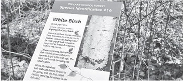
Committee members have also designed and installed interpretive panels across the entire trail system in addition to creating a trail guide, which is available at the kiosk at either of the two trailheads. There are 17 tree species panels and 14 cultural panels. The second set highlights geology, history and current forest activities. Rest stops are being planned for the two high points on the system, which sit high atop glacial eskers and give trail users a great workout and a great view over the forest. Volunteers with the committee urge community members to watch for future upgrades as they continue to make more improvements.

On Saturday, May 3 there was a log cutting ceremony to relaunch the new and improved trails. Through the event, community members were invited to come use the school forest trails throughout the year to reconnect with nature and learn about the history, geology and environment.

The School Forest Interpretive Trail is only a small section of a vast network of ski and snowshoe trails connecting county forest, school forest, private land, and Forest Springs land in this area. Four segments totaling 1.73 miles have been posted with teaching panels to enhance your forest experience.

In general, all four sections of the interpretive trail converge at either the Thums parking lot on Harper Drive or the parking lot on County Highway D. People should feel free to walk the trails in either direction and explore the area between the trails as well. The Boardwalk Segment is the flattest, most accessible trail in the school forest with gravel surface and fivefoot wide boardwalk. The Esker and North Segment have the greatest elevation change ranging from 1,620 feet at the lowest point to 1,698 feet above sea level at the ridge top. The Flatlander is moderate in difficulty.

Flatlander Segment 0.57 miles Esker Segment 0.39 miles Boardwalk Segment 0.32 miles North Segment 0.45 miles

LATEST NEWS