Working together


The newly adopted floodplain maps for Taylor County have a mistake in them.
However, as residents and county board members attending the December 14 county zoning public hearing on adopting the maps learned, the deadline for easily correcting any mistakes came and went more than two years ago.
Last week’s public hearing was largely just a formal step in the process to make sure that county residents who need it are able to get flood insurance and will qualify for disaster relief in the event of a flood.
“This is a proverbial rock and a hard place,” said zoning committee member Mike Bub of the floodplain maps and proposed floodplain ordinance.
“You have to approve the maps if you like them or not,” he said noting “this is one of those votes where you have to plug your nose and vote.
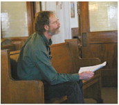
Gary Zielske of Ellsworth owns a cabin on property at W8623 CTH D, about 1.7 miles below the dam at the See ZONING on page 4 Mondeaux Flowage. According to the new floodplain maps, Zielske’s cabin is in the floodplain. This can have a major impact on the future resale value of the property and could require him to get flood insurance.
Zielske says his cabin isn’t in the floodplain and has the paperwork filed with the state and county from 1997 to prove it, including elevations shot by a forest service engineer and a letter from the engineer. His cabin sits on a higher area that rises from the surrounding landscape, a feature that is clearly visible on the various aerial and topographic maps of the region available online.
“Our house is well above the flood shadow, but the driveway is in the flood shadow,” he said.
“It is clearly an oversight,” he said. Zielske came to the public hearing asking for the county to reject the section of map that includes his property and send it back to the Federal Emergency Management Agency to be corrected.
“I know you want to approve the maps today. My hope is that you make an exception for this panel and refer it back to FEMA for correction,” he said.
Unfortunately for Zielske it isn’t that easy.Representatives from the Wisconsin DNR explained that the time for making corrections like that was during a review period for the maps which ended two years ago. Now, property owners seeking to make changes must go through the process of filing a letter of map amendment (LOMA). This typically requires a property owner to hire a surveyor to shoot the elevations and then to send a letter to FEMA asking for the change. The process can take anywhere from 6 weeks to two to three months for a response on a LOMA request. While there is no fee charged to file a LOMA, there are costs to hiring a surveyor or engineer to prepare the information.
“I have to hire an engineer and surveyor to correct a mistake someone else made,” Zielske said.
Zielske said he primarily wants the map rectified because it impacts the property’s land use and value in the eventual situation of when his wife will need to sell the property after he passes.
Zoning administrator Kyle Noonan agreed that the maps have an error with the correct information documented in the county. He suggested that Zielske should use the documentation he has from 1997 and submit that as part of a LOMA request to FEMA. If that is not accepted, he suggested the county through his office and the surveyor’s office, could assist Zielske in getting the information needed to file a LOMA. Noonan said he hates to put additional work on another county employee, but feels this is a fair exception to assist the property owner especially when the documentation already exists at the county.
Ryan Jarvis a water management engineer with the DNR said Zielske’s concern were valid and said they are following a process that FEMA has set up.
“We are here to try to help move pieces within a large county,” Jarvis said of the floodplain process.
According to Jarvis, regardless of if the county approves the maps and ordinance or agrees to participate in the national flood insurance program (NFIP) lenders, particularly those using federal loan programs, will follow the maps as prepared by FEMA.
“The mortgage lenders still will use the FEMA maps whether the county does or not,” Jarvis said.
Committee member Rollie Thums said it sounded like their arms were being twisted. “I don’t want the citizen of this county losing anything,” he said.
Committee members agreed with Noonan’s recommendation to assist Zielske with county resources in order to file the LOMA.
In addition to Zielske, Tony Yaron who owns property at N3194 River Road in Hammel spoke expressing his frustration with the process.
“We were pretty much left in the dark until Nov. 20,” he said of when he received notification from the county about the hearing. The county had taken the extra step of sending a notification to the owners of the 34 county residential properties that were impacted by changes in the maps.
Noonan noted that overall the county saw a drop in the number of residences in the floodplains from 55 under the old maps to 34 under the new maps.
Bub said he sympathized with the owners of the properties, but also noted that they need to help protect residents from disasters.
In the end, committee members, during their meeting after the public hearing, voted to adopt the model ordinance from the DNR as presented and send it to the full county board for action at the January 16 meeting.
In related action, committee members also voted in support of the county participating in the national flood insurance program. There is no cost to the county to participate in this program.
In other business, committee members:
Received an update on sanitary permits issued. Noonan said they were in line with previous years. He said there were 54 new sanitary permits and 44 replacement permits this year for a total of 98 compared to 107 issued last year. There have been 36 shoreline zoning permits this year compared to 30 last year. “We are pretty close to average,” he said.
Received an update on sanitary system maintenance citations. The county had sent out 641 noncompliance notices and as of the meeting were referring 10 to the sheriff’s department for citations.